Summer Day Camp Options for 2016 for Beacon Families in the Hudson Valley

A Little Beacon Blog's Summer Day Camp Guide for Beacon Families in the Hudson Valley 

It's here! A Little Beacon Blog's Summer Day Camp Guide! The choices are amazing, and the decisions are not easy. You will need to get out a few calendars for this - your calendar, the grandparent's calendar or anyone who is helping to shepherd the kids around during different weeks of camp locations and times. Our guide is organized by Age, Times, Dates, Prices, Early/Late Options, and everything you need in one place to see what you want to do.

Maybe your phone has already been blowing up with texts from friends: "What weeks are you doing????" Camp with friends can make things easier, yet making new friends does eventually happen, despite that first day of "Who will play with me?" terror.

So, start your calendars, because we've got LEGO Star Wars, Farm Camps (two different ones!), Art Camps, Fashion Camp, High Activity Camp, Field Trip Camps, Gymnastics Camp, Film Camp, and Theater Camp. This Guide is updated every year. Like all of our Guides, it's live-action, meaning, it never gets old. We update it constantly.

Good Luck!


Lottery for Long Dock Kayak Storage Starts Now! A Sure Sign of Spring!

The kayak pavilion at Long Dock Park prior to rental season.
Photo Credit: Katie Hellmuth Martin


Spring has been showing its frostier side around the Hudson Valley recently, but steamy hot days will be here before we know it. What better way to cool off than heading to the Hudson River, and what better way to enjoy the crisp waters than in a kayak or canoe? If you have your own river-faring vessel like a kayak, you have a shot to store it right at Long Dock Park in Beacon!


That’s right, the 7th annual lottery for kayak/canoe storage at Scenic Hudson’s pavilion at Long Dock is happening. Now through Friday, April 22, 2016, hopeful paddlers can enter the lottery by filling out a form here at Scenic Hudson’s website. People whose entries are drawn from the lottery will be notified by Friday, April 29. The storage pavilion's season runs from May 7 to October 31, and use of the storage costs $175. If you have any other questions, call Laura Sumner at (845) 473-4440, ext. 247, or email her at lsumner@scenichudson.org

The area that we now know and love as Long Dock wasn't always so welcoming, however. For many decades, it was a bit of a wasteland. A history of industrial use and general neglect left a lot for Scenic Hudson to turn around. But turn it around they have, after some serious cleanup and soil remediation work, not to mention the incredible landscaping with Hudson Valley native plant species. The park has even won prestigious national awards for its design and - in true Beacon fashion - environmentally friendly aspects! Thousands of people now visit Long Dock every year to spot wildlife (including bald eagles!) and enjoy the expansive river views. Check A Little Beacon Blog's Annual Events Guide for when Scenic Hudson conducts their riverside cleanups, and sign up for our newsletter that tells you what is going on each weekend so that you don't miss it!

If you haven't tried kayaking or canoeing, you can still get hooked on paddling. Longtime Beacon shop Mountain Tops Outfitters rents watercraft by the hour or day, and they even run kayak tours from Long Dock to Denning's Point and Bannerman Island during the summer. Who knows - you might enjoy it so much that you'll be a 2017 lottery hopeful!

Sundays Are Complete Again! Beacon Flea Market Opens April 10, 2016

The Beacon Flea Market Opens for the Season April 3, 2016, and has Spent Winter Running Estate Sales

Did you find yourself walking aimlessly down Main Street this winter, taken in with all of the shops of course, but missing your anchor, that nudge in the back of your mind of something you wanted to do but couldn't put your finger on?

That is because Beacon Flea was closed for the season, the outdoor flea market located behind the Post Office in the parking lot at 6 Henry Street that is open every Sunday from 8am-3pm weather permitting. Perfect for walking through with a cup of coffee from a nearby cafe, or full belly from brunch from these eateries or a Belgium waffle at the Yankee Clipper Diner. The flea market will be open again on April 10th through the Fall.

UPDATE: Due to the snowy weather on April 3rd, the original opening day, Beacon Flea moved it to April 10.

When Emma Dewing, Owner and Market Manager of Beacon Flea, announced on her Facebook page that the Beacon Flea had just signed a contract with the city for another near of flea marketing, the post was shared over 65 times. Says Emma: "People are excited for the market to open. It heralds Spring, warm weather, and a terrific social event in the heart of Beacon. On a Sunday morning, customers walk to Main, grab coffee, meet friends and neighbors in the Flea Market and hunt for vintage and handmade treasures! There is a buzz that is just wonderful, and I am so thrilled for Beacon!"

Estate Sales From Beacon Flea

Those in withdraw from hunting for treasures outside could still attend Estate Sales Beacon Flea put on throughout the Hudson Valley.

Photo Credit: From Beacon Flea's Instagram page.

Beacon Flea Now Accepting Vendors

Got something you want to vend? Beacon Flea is now accepting vendors. Welcomed items include vintage, retro, antique, junk, salvage, architectural elements, collectibles, attic clean-outs, yard sale, costume jewelry, art, musical instruments, and hand made items. Any questions, contact Beacon Flea directly for more information: beaconfleamarket@gmail.com  (845) 202-0094.

A photo posted by Emma Dewing (@beaconflea) on


A photo posted by Emma Dewing (@beaconflea) on


A photo posted by Emma Dewing (@beaconflea) on
 

A photo posted by Emma Dewing (@beaconflea) on

Fall Foliage | The OMG Edition in The Hudson Valley 2015

Photo Credit: @danilynphoto

The peak season is here for fall foliage in the Hudson Valley! Anywhere you go, you are getting a glorious view of this beautiful area. To really indulge your imagination in the Hudson Valley, read through the first chapters of Native New Yorkers where the author, Evan T. Pritchard, describes New York City as lush and full of fruit trees, before pavement and buildings. We love pulling photos from our Instagram files, and reached out to each of these sight-seers who shared their photo in their stream. Thanks to these Instagrammers for sharing their visions with their streams and now with A Little Beacon Blog. Each photographer is credited below. Enjoy!

Not a painting, but a real life tractor in the Shawangunk Mountains as spotted by Lauree Ostrofsky.
Photo Credit: @simplyleap


Run through that field and under the trees at Hudson Highlands.
Photo Credit: @hhnaturemuseum

Woa. View from Shawangunk Ridge.
Photo Credit: @kelseykleidman


Slice of yellow.
Photo Credit: @beacon_transplant

Folks from People's Bicycle riding at Beacon's reservoir.
The Reservoir is quite low, and Beacon is in a Stage 2 Drought Emergency.
The reservoir is at 40% capacity and one well is out of service.
Beaconites are encouraged to reduce water consumption by 20%
Photo Credit: @peoplesbicycle

Curiouser and curiouser.
Learn about a hike like this at Madam Brett Park.
Photo Credit: @natalijewel

So spookily beautiful at Ward Pound Ridge.
Photo Credit: @danilynphoto


Fall Foliage 2015 at the firetower on Mount Beacon.
Could this be you? Get ideas in A Little Beacon Blog's Hiking Series.
Photo Credit: @briannax241

Denning's Point Hike: Walking The Rise & Fall of American Grandeur During the Industrial Revolution to the Jazz Age

Look at the bald eagle perched above you. The Wiccappee Indians saw them too. Stand on the clay and rock of the beach and watch the tide, George Washington and Alexander Hamilton did as well. Tucked away and easy to bypass, Denning's Point is as filled with as much history as it is with dense, diverse nature. Take in the breathtaking scenery and terrain of this 1.2 mile circuit trail, and take your time to inhale the vast history of it as well.

Denning's Point

The Nuts and Bolts of the Denning's Point Hike

You can park in the parking lot off of Denning's Avenue and take the little connector dirt road to the overpass going over the railroad and onto the point. You can also access the trail via the Madame Brett connectors or the Klara Sauer Trail. The point is actually a peninsula that juts out into the Hudson River, and is the northern-most point of the Hudson Highlands state park. It’s a flat hike that is full of native and invasive species of flora and fauna. The most common of these invasive include water chestnut, which blankets huge swaths of the river around the point, buckthorn, Asiatic bittersweet and swallowwart. You’ll also find, as you pass several old abandoned buildings, a multitude of tree species from maples to cherry and apple, as well as shrubs of honeysuckle, sumac and tastier varieties like black and elderberry, autumn olive and more. If you are into foraging, be sure to look out for wild ginger, burdock, garlic mustard, field garlic, asparagus, thistle, strawberry, milkweed, St. Johnswort and much, much more! One could open an apothecary just on the bounty around Denning's Point. (While on the beach, try and find remains of an old cider mill for Pippen apples, the apple orchard once maintained here for “Fishkill champagne”!). And don’t forget about the bald eagles-the park is a nesting place for them, and is actually closed during the late fall through winter months to protect their nesting periods. 

The trail forks just past the large abandoned factory. You can take either loop, and both will run course along the river, eventually opening up to gorgeous views of the Hudson, the highlands, and Newburgh. The rocky beach area has a near deserted Island feel and is a delightful respite from the dense wooded trail area where you can relax to the lapping sounds of water and rays of sunshine. The 1.2 mile loop is a fairly even grade, though getting down to the beach area is a little steep, but well worth it. Allow for an hour at least to take in all the nature and scenery. 

The History of Denning's Point

Archeologists have found evidence of inhabitants as far back as 4000 B.C. in this outcrop on the Hudson River. The Hudson River historian, Arthur Adams had pointed out that Wiccapee and Shenandoah Indian tribes had used it as burial grounds. And the history only gets better from there. The site was initially part of the large Rombout Patent, the large land purchase by Frans Rombouts and the Verplank family from the Wappinger Indians. The daughter of Mr. Verplank, Catharyna, built a grist mill just off the point in the beginning of the 18th century after marrying a Roger Brett. After he passed, Madame Brett in the middle of the century, sold the land to Jacob de Peyster, who renamed it DePyester’s Point and built on it. During the American Revolution, the point became and eastern terminus for the war efforts. General Washington was said to have walked the point himself and spent time on conducting war business there. It was an important part of the transportation and strategic planning for the Patriots. So important in fact that Alexander Hamilton actually rented one of DePeyster’s homes on the point, and wrote the precursors to The Federalist Papers while here! One can imagine, with the types of men Washington and his generals were, that they perhaps picked, or even introduced some of the edible shrubs and herbs around the hike, although a local trail leader suggests that a renown female horticulturalist introduced several plants. Shortly after the war in 1785, Washington Staffer, Adjutant-General William Denning purchased the land and built his own mansion, “Presqu’ile” on 45 acres of the southern point.

William Denning's mansion built on 45 acres on the southern point.
Photo Credit: Jim Heron sharing his knowledge on Beacon Citizen.


A century later, after turnover from a bankrupt railroad, the site was converted to a brickworks factory and fanciful homestead by Newburgh resident Homer Ramsdell. In your traverses around Beacon, you might have found bricks labeled “DPBW,” (or Denning's Point Brick Works).


Bricks from the Denning's Point Brick Works.
Photo Credit: Katie Hellmuth Martin

At Presqu’ile, all the splendors (and eventual downfalls) of the pre-industrial antibellum age were experienced by Emily Denning Van Rensselaer et al, with the sweeping lawns and elegant parties. But amid this grandeur, Ramsedell, or “Old Man Tardy” as he was known to some, cleared a third of the point for clay and sand to make his bricks. Soon the point was swarming with industry and immigrants (some of whose relatives still live in Beacon today) and Emily Van Rensselaer left but the brickworks was going steady (eventually pulling out of the point in 1939). Several decades after Emily left, in the 1920’s, the estate was in ruins having been vacant, then settled by brick-worker families, then vacated again. But that didn’t stop the point from being an attraction. 

The 1920’s and 30’s were a buzz-worthy time for the point. Thousands of locals and travelers came to Denning's Point to swim in the brackish waters and enjoy Sunday music and a lively resort. Ferries would motor guests across the river from Newburgh, and coaches would haul picnic-goers from all over. On a typical weekend day, the little beach would be packed with sunbathers and partygoers, often dancing away to live music. So much so, that the little park was called “The Coney Island of Dutchess County.” 

(Source: Beacon Revisted, by Robert J Murphy, Denis Doring VanBuren)

After exchanging company hands for the next handful of decades (a construction paneling company, Durisol, and a pin ticket manufacturer called Noesting), the point was eventually purchased by the State of New York in 1988. In 2003, then Governor George Pataki chose the site for a new research facility, Rivers and Estuary Center, now Beacon Institute's Center for Environmental Innovation and Education. To learn more about the remarkable history of Denning's Point, check out Denning's Point, A Hudson River History by Jim Heron


Extend Your Stay on the Trail…

Expand the 1.2 mile loop by continuing on to the Klara Sauer Trail along the river once you exit the point. This trail will bring you out to Long Dock Park. Or you can turn right from the trailhead when heading over the train tracks to the parking lot to traverse the new Dave Miller Connector trail that marries Denning's Point to Madame Brett Park and on to the waterfront. My wife and I typically do the whole loop, starting from Tioronda and continuing on to Madame Brett, the connector and do the entirety through Denning’s Point to the waterfront which is a great way to see the beautiful, historic rim of Beacon!

Denning's Point perfectly encapsulates the great and often turbulent narrative of America, from the Native Americans, to Henry Hudson, the American Revolution; from the Federalist grandeur and antebellum culture to the rise and fall of industrial America. The remarkable diversity of plant species and gorgeous river views will certainly help you appreciate the history even more.


Please welcome back contributor Dylan Price, a writer/filmmaker and avid outdoorsman who moved to Beacon with his wife from Washington D.C. They were attracted to Beacon for the unique mix of nature, art and food. Dylan will continue to explore and share the more historical aspects of our local trails for our Hiking Series.

Cat Rocks: Family-Friendly Hike in Pawling

Today we’re going to hike The Appalachian Trail. Well, 0.07% of it.

Your kids probably aren’t quite ready to hike 2,150 miles from Georgia to Maine (although they might be), but this 3-mile round-trip hike to the scenic overlook known as Cat Rocks, just below the summit of West Mountain in Pawling, is a good introduction to the AT.

Expect some company: Cat Rocks can be a crowded spot. It’s the halfway point in a popular 7.5 mile day hike that goes from the Appalachian Trail Metro-North stop on Route 22 all the way to Route 55 with a stop over at Nuclear Lake. (Guess how Nuclear Lake got its name? You’re right!) But it’s always fun to meet people who are in the middle of through-hiking, or at least tackling large sections, of the AT, and this hike even gives you a chance to check out an AT shelter.

We especially enjoy this hike in early spring when the skunk cabbage has emerged, seasonal snow-melt streams are rushing, and tasty fiddleheads and ramps can be found if you keep an eye out. Plus, since the trees haven’t filled out yet, when you get to Cat Rocks you might be able to see your car parked at the bottom.

Cat Rocks lookout in spring
On the other hand, I’m starting to think that the view from Cat Rocks is probably even better in the fall during peak leaf season. Anyone want to head up for a hike this fall?

  1. Begin by parking here on West Dover Road/Route 20, by the massive, 300-year-old oak tree known as the Dover Oak. More than one guide to the AT claims that the Dover Oak is the largest blazed tree on the entire 2,150-mile length of the trail. Speaking of blazes: You’ll be following the white blazes for pretty much the entire hike.
    Parking area
    Appalachian Trail
  2. Cross the road and take the stairs down into the skunk cabbage marsh. There are some boardwalks to take you over the muddiest parts, but you should still be wearing something waterproof on your feet. 
  3. After the marsh is the hike’s only tricky part: a rocky outcropping that you’ll have to scramble up. The ascent is gradual enough that it’s not too difficult, but if it has rained recently, the rocks can be quite slippery. Take your time, and keep a hand on the wee ones as you guide them up the slopes. 
    Rock scramble
  4. It’s smooth sailing from here. You’ll soon reach a wooden bridge that traverses a seasonal stream. Also, look for a tree on the left side of the trail right here that Cooper swore looked like a giant dinosaur foot.
    Exploring the stream
  5. Shortly after that is the junction with the 0.1 mile-long blue trail, which branches off to the left. It’s worth your time to check it out. Not only is there a beautiful rushing stream with cascades and frog ponds, but it also leads to the Telephone Pioneers Shelter - so named because it was built by the White Plains chapter of the Telephone Pioneers back in the 1980s. The Telephone Pioneers is what they used to call the volunteer service programs run by the various telephone companies. Today they’re known as the Telecom Pioneers because landlines? LOLOLOL. What’s also notable about this particular shelter is that a mini-library is attached to it, run by the Pawling Free Library. Hikers are encouraged to take, or leave, a book. The last time we visited the shelter we ran into a section hiker named Gas (all AT hikers give themselves a trail nickname) who had so far hiked the AT all the way up from Georgia, and he told us that was the first library he’d ever seen attached to a shelter. 
    Appalachian Trail: Telephone Pioneers shelter
  6. Backtrack to the junction, and continue along the white-blazed trail for the final push to the top. Cat Rocks is actually just off the trail itself. You’ll see an unmarked trail branching off to the right around here, and the view will be partly visible. Head right for about 100 feet and you’re there, facing east. Plop yourself down and have a snack! If you want to reach the true summit of West Mountain, head back to the trail and push ahead another 0.1 mile for a north-facing view. 
    Almost to the lookout
  7. From Cat Rocks, backtrack down to the trailhead. Again, use some caution when you reach the rocky, sloping outcrop near the trailhead. Honestly, we’ve found that it’s easier to just slide down most of it on your bottom. We call it “booty-scootin’” which Coop find hilarious. Then he won’t stop saying “BOOTY SCOOTIN’! BOOTY SCOOTIN’!” for, like, days. You know what? Maybe it’s better to walk down.
    Cat Rocks lookout in summer
Round-trip distance: Just under 3 miles.

Where to park: The parking shoulder is here on West Dover Road/Route 20, on the side with the giant oak tree (trust me, you can’t miss it). If you’re coming from the south: If you pass Valley View Farms Road on the right, you’ve gone too far by about a mile. If you’re coming from the north: Once you pass Valley View Farms Road on the left, start paying attention, because you’ll hit the trailhead in about a mile.

What to pack for the kids:
  • Snacks and water
  • First aid kit
  • Insect repellent (The bugs can be bad on the trail’s swampier sections in the summer.)
  • Binoculars 
  • Waterproof shoes with good grips
  • Maybe even a book to leave at the shelter library

Brian PJ Cronin, editor of Hudson Valley Parent magazine and local writer extraordinaire, shares his writing talents in focusing on family-friendly hikes for our Hiking Series. The beautiful photography is by Kristen Cronin, local do-gooder and co-founder of For Goodness Bake.


Sugarloaf Hill: Family-Friendly Hike in Garrison

Please welcome back our contributors: Brian PJ Cronin, editor of Hudson Valley Parent magazine and local writer extraordinaire, shares his writing talents in focusing on family-friendly hikes for our Hiking Series. The beautiful photography is by Kristen Cronin, local do-gooder and co-founder of For Goodness Bake. Enjoy!


Today’s hike takes us to Sugarloaf Hill in Garrison. Not to be confused with Sugarloaf Mountain in Cold Spring or the Sugarloaf Mountain ski resort in Maine or the Hudson Valley town of Sugarloaf over in Orange County or the approximately 14,000 other things in the Northeast named “Sugarloaf.” It’s a bit of a common name. Until the late 19th century, before granulated sugar became a thing, refined sugar was processed via conical molds. Once the process was done, the sugar came out of the mold in a tall, mountainous shape, called a sugarloaf. And since early Colonial settlers were too busy trying not to die of starvation and/or dysentery to be creative, they pretty much named every other mountain they saw “Sugarloaf.” So when your kids ask what a sugarloaf is, now you know what to tell them! You can leave out the dysentery part, though.

The parking lot and trailhead are across from the Garrison Institute on Route 9D.
  1. From the parking lot, backtrack the way you drove up and hang a left. Keep following the dirt road as it heads towards the hills and then bears right at another gate. You’ll start to notice red trail markers, which are the markers you’ll be following all the way to the top.
  2. Take a left into a big, beautiful meadow of tall grass and wildflowers. From here the trail is usually mowed into the grass. As you begin to ascend through the meadow, look back and you’ll get a fantastic view of West Point. Keep in mind though, as you’re all getting your Andrew Wyeth vibes on, that if you’re hiking this trail between May and July that you’re basically walking through tick-alapooza. So stick to the mowed parts, use a good tick repellent from the knees down, and do thorough tick checks on the whole family when you get home. (I should add that in the five or so times we’ve done this hike we’ve never found a tick on us, but better safe than sorry.)

  3. Partway through the meadow, the trail splits. Head straight, into the woods, and you’ll come across a wooden gazebo. Turn right, into the woods, for a small shortcut. Both paths shortly meet up again, so take either one.
  4. After crossing a small brook, the trail begins to wind up the hill. Keep an eye out for those red trail markers. There’s plenty of unmarked trails that branch off and lead to private property. On your way up, look for a large climbing boulder, a cairn atop a stone pillar, and a frog pond.
  5. Shortly after the pond you’ll come to a junction. The blue trail begins here and continues straight ahead. There’s another wooden gazebo just up ahead, if you’ve got a bit of time and want to check it out. Otherwise, hang a right to follow the red trail as it ascends. This is the only steep part of the hike, so littler hikers may need a hand here. Fortunately, the ascent is short and you’re almost to the top.
  6. In a few minutes you’ll top out at the ridge. Keep following the trail along the ridge until you reach the end point, with scenic views facing south on the Hudson River. Look around a bit and you’ll find a very rare sight for the Hudson Valley - wild cacti growing near the rocks. Yes, cacti can grow this far north, but the conditions have to be just right. And Sugarloaf Hill is one of those very special places in the Valley that’s got just the right mixture of rockiness, access to open sunlight, and ample drainage within the soil to make that happen.
  7. Backtrack down the hill to return to the parking lot. And check for ticks!
Round-trip distance: 3.1 miles

Where to park: To get to the parking lot, look for the stone gate across from the Garrison Institute on Route 9D. Above the gate, you’ll see a brown DEC sign with yellow letters that reads “Castle Rock Unique Area.” The gate says “Wing & Wing” on it. Bear left on the dirt road, and follow the signs to the lot.

What to pack for the kids:
  • Snacks and water
  • First aid kit
  • Sunscreen and hat (You’ll only need these for the beginning; once you get past the field the rest of the hike is pretty shaded.)
  • Tick repellent
  • Tick key or tweezers
  • Map (See the “East Hudson Trails” map #101 of the New York-New Jersey Trail Conference Series, which is sold at Mountain Tops.)

Mount Beacon: Historical Hike

Please welcome contributor Dylan Price, a writer/filmmaker and avid outdoorsman who moved to Beacon with his wife from Washington D.C. They were attracted to Beacon for the unique mix of nature, art and food. Dylan will explore and share the more historical aspects of our local trails for our Hiking Series.


Hiking Mount Beacon
Forever peering over her town, Mount Beacon is perhaps the first trail in the conversation of where to hike around Beacon. The day hike offers many a chance to take in much of the beauty and bounty of this area, in one spot. 
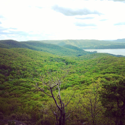
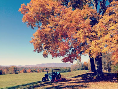
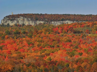
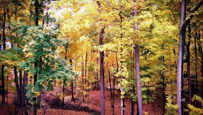
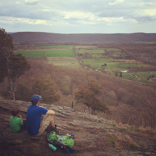
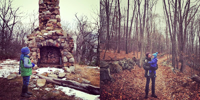
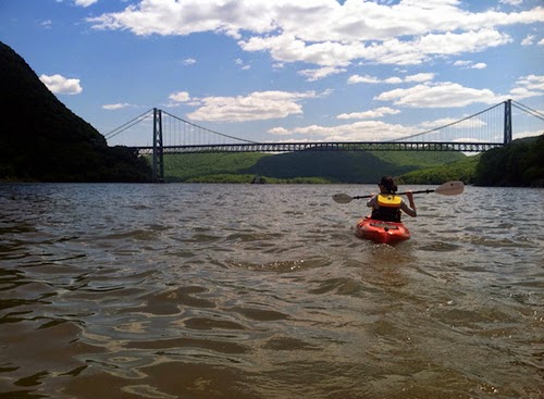
 
Beautiful Views

The Nuts and Bolts of the Mount Beacon Hike
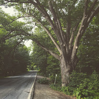
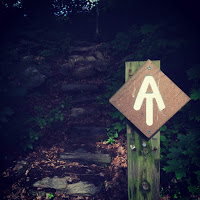
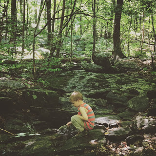
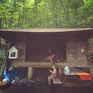
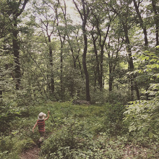
The trailhead begins in the parking lot off the intersection of Route 9D and Howland Avenue. It is a good day hike, if not strenuous at times, so remember to bring water and snacks. If you happen to forget, Bob’s Corner Store is just across the street. After parking, it is a short quarter mile amble past a creek and wooded area, where at dawn or dusk, you’ll often find deer, woodpeckers, flycatchers, passer birds cutting between the flagging hawks, falcons, and eagles. The hike begins at the ruins of the old incline railway, a specter of the past glory of Beacon running up the mountain like an old rusty back-brace of the bygone city. Climb the metal stairs to your first restful panorama and head up the trail from there following the red burn Casino trail markers.

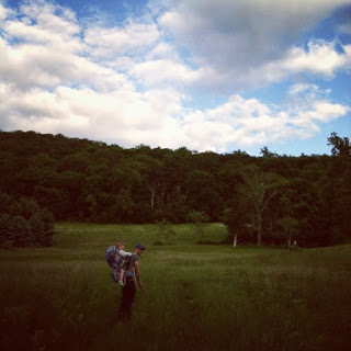
Mount Beacon is a hike full of switchbacks and graceful views from various plateaus as you make your way up the 1000 plus vertical ascent. Early on in the hike, a spur off a connecting switchback leads you to a small outcrop observation deck built by volunteers. Much of the hike is covered under a canopy of various deciduous and coniferous trees. As you reach the summit, the topography gets a bit more rocky and open. The summit of Mount Beacon is certainly a pay-off with viewpoints of almost the entirety of the region.

Allow around three hours for the out-and-back on just the mountain itself, and on a nice day, expect company on the trail (including dogs). The hike is sometimes strenuous, but it is certainly rewarding. During the fall and early spring, views are expansive and follow you up the mountain when the leaves are down and the crowds aren’t as great. 

The Incline in its heyday
The History of Mount Beacon
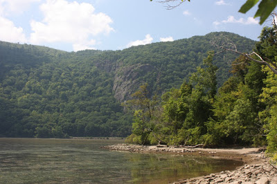
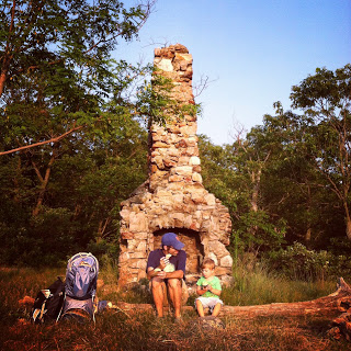
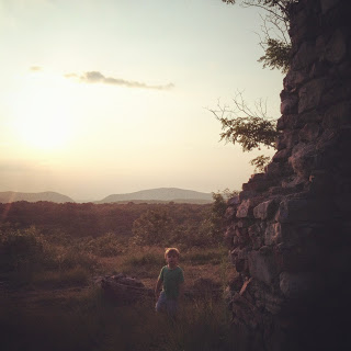
Standing on the foundation of the old Mountain Top casino and Beacon Crest hotel (both having succumbed to fire), your views are limitless and awe-inspiring. History surely unfolds in a panorama at this point. The Daughters of the American Revolution, in 1900, dedicated a monument here for the soldiers of the continental army who lit bonfires (beacons) to warn of British troop and ship advances. Vernon Benjamin, in his great book “The History of the Hudson River Valley: From Wilderness to the Civil War,” discussed certain…crafty European businessmen who, during the colonial era, purchased the land from the Wappinger Indian tribe in the area. They made a deal that they could buy all the land they could see, and after agreeing to those terms, promptly hiked Mount Beacon and claimed their lands. Standing there, you can appreciate the cunningness of these men and the vast beauty of the Hudson Valley. When you reach the top, you really get a sense of the vastness and history of the valley. Explore the uneven summit and the various relics of the past up here, but don’t forget to take in the panoramic views reaching far across to the Catskills and bending along the river, as Mount Beacon is the highest peak in the Hudson Highlands.

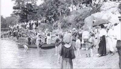
Thousands would flock on grand ferry's up the much-traversed Hudson, or take a long train ride into Beacon or Newburgh. Combo-tickets were sold by the hotel for travel by ferry via Newburgh, to the trolley on the other side of the river which took them to the incline, then bringing them up a 65% graded rail to the top. The incline opened on Memorial Day, 1902. The first year alone, 60,000 people came. Life atop the mountain was grand, packed with party-goers, the cool breezes lifted people from the sweltering heat in Beacon and Newburgh, and attendees to the hotel and casino enjoyed long walks around the park, spring-fed aquifers and plenty of games, food and dancing, all while dressed to the nines. Some would stay for weeks at a time. The casino held many big-band dances, some of the most famous names at the time performing there, and every Saturday during the summer grand parties were held. At one point during its golden age, the entire incline was fully illuminated, and the lights leading up to the summit could be seen from miles away. Cottages were built scattered along the mountainside for summer retreats, and a popular radio station was broadcasted from the top as well called "The voice from the clouds."

In its heyday, with the casino and hotel garnering hundreds of thousands of tourists, Hollywood stepped in to utilize the natural beauty of the mountain. The top of Mount Beacon was used for several silent movies in the 1920's including a popular Western silent film, D.W. Griffith’s “The Red Man's View” which was meant to depict a long march in the rugged western lands.

In 1927, a year after the summit attained its most visitors in one year, a midnight fire in the casino burnt the complex down. They began new construction the following year, but the nation fell into the Great Depression and it went unfinished. In the following decades, the incline remained in operation, but business fell off despite the steady flow, and touristy-draw of being the world’s steepest incline railway at the time. Fire struck three more times, once in 1934 destroying part of the track, and again in 1967, this time burning the lower station and rail car. The last fire, in 1983, finally took the great railway down for good.

The historic mountain, which is depicted on the New York State flag, has seen many changes come its way throughout the centuries. Take your time exploring, appreciating, and conserving the beauty and history of this hike.  There is an active group restoring the incline railway, which you can learn more about via their website, and the conservation group (and owners of the land), Scenic Hudson.

Extend Your Stay on the Trail…
Expand the 2.4-mile out and back hike by pressing on to the old fire tower, which offers even more impressive views and further seclusion. When you are at the summit of Mount Beacon, turn from the river to look at North and South Beacon Mountains. The tower is set on the southern mountain, which you can see from there. The hike to the tower will almost double your outing, and allow you to ascend another 500 plus feet over the extra mile out. On a clear day, you can see all the way from Manhattan up to Albany.

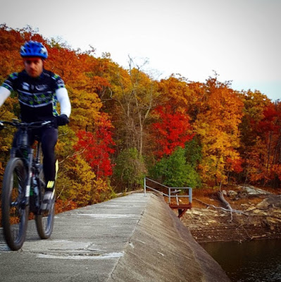
If you are after an even longer hike, try for the Beacon Reservoir nearby, which sunders Mount Beacon and Scofield Ridge in Putnam County. And even farther yet, the connecting Fishkill Ridge via Wilkinson Memorial trail, which connects to the mountain via yellow burns. This will tack on another 3 plus miles and over 1,000 feet more in vertical ascent, but will give you an ecological study of nearly the entirety of the Hudson Highlands. For now though, allow the scripting vultures and eagles to mark this long ridgeline for you from atop Mount Beacon as you rest and refuel for the trip back.

Earl’s Chimney: Family-Friendly Hike in Garrison

Please welcome our contributors: Brian PJ Cronin, editor of Hudson Valley Parent magazine and local writer extraordinaire, shares his writing talents in focusing on family-friendly hikes for our new Hiking Series. The beautiful photography is by Kristen Cronin, local do-gooder and co-founder of For Goodness Bake. Enjoy!


Hi! My name is Brian PJ Cronin and I’m honored that Katie has invited us to share some of our favorite family-friendly hikes in the Hudson Valley with the readers of A Little Beacon Blog.

For our purposes, we’re defining “family-friendly” as “any hike that our 3.5 year old son Cooper can walk all by himself with a manageable amount of complaining.” Although we also always tell him that if he can make it through the entire hike without being carried, he can have ice cream. Your mileage may vary.


For our first hike, we’ve chosen Earl’s Chimney in Garrison. This out-and-back hike is just over two and a half miles long (round-trip) and features a scenic overlook at the site of an old camp cabin. Only the stone chimney remains at the site, hence the name. In case you’re wondering who Earl was, or when the cabin was built, or when it was destroyed, here’s your answer: I don’t know. I even checked with the Putnam History Museum, the Putnam County historian, and the Garrison Fish & Game Club and they don’t know either. But your kids are going to ask, so better make something up. My suggestion? Ninjas.


This hike starts at the Moneyhole Mountain Access trailhead, located just across from the Garrison Fish & Game Club.

  1. Begin by taking the green trail north, as it rises and falls through pine forests and next to the bubbling Phillips Brook. There are a few opportunities to go off trail and head down to the creek if you wish, but the creek will be coming to you soon enough. We always hear woodpeckers during this first section of the trail, so keep those ears open!
  2. Soon you’ll hit the first intersection as the green trail ends and meets up with the yellow Catfish Loop. Turn right.
  3. Now the pines thin out and are replaced by scores of mountain laurels. The trail flattens out and crosses over the brook a few times, as well as a few swampy patches. Now would be a good time to mention that you should make sure you’re wearing waterproof boots. This middle section of the trail is short, but offers plenty of opportunities for puddle-splashing and creek-dipping, so you might want to factor that into your time management. One of the creek crossings also features a small hole in the rocks that you walk over, so that you can look down and see the water rushing beneath you. I am pretty sure that Cooper would live at this part of the trail if we let him.
  4. Eventually things dry out and the white trail begins to the right. The pine trees return, and during one point the trail even passes under a broken tree that fell against another tree, creating a sort of “tree arch.” As you take the white trail, you’ll finally begin to notice that you’re starting to ascend. Actually, you’ve been climbing this whole time, but so gradually that you (and your little ones) probably didn’t even notice.
  5. Soon you’ll top out at Earl’s Chimney itself, 216 feet above the trailhead. Your view is directly facing the Highland Gap across the river, which holds West Point inside of it. Look down and you’ll see parts of the Garrison County Club spread out before you.
    (Note that around the summit are several blueberry bushes, but also several buckthorn bushes as well. Buckthorn berries are similar to blueberries except they’re slightly darker, lack the distinctive “crown” that blueberries have near the base, and can cause severe cramping and diarrhea. So make sure you pack enough snacks so that hungry little hands don’t get grabby.)
  6. Backtrack from here to return to the trailhead. Just remember to turn left at both intersections now instead of right. Then, family reward time!


Round-trip distance: 2.7 miles

Where to park: By the Moneyhole Mountain Access trailhead, across from the Garrison Fish and Game Club, 183 South Highland Road. There’s a parking turnout down the street a bit, across from the lake.

What to pack for the kids:
    • Waterproof shoes or boots
    • Snacks and water
    • First aid kit
    • Binoculars (We always forget to bring these and always regret it.)
    • Sunscreen and hat (most of the trail is shaded, but the terminus is open and sunny)
    • Bug spray (just in case)
    • A map (See the “East Hudson Trails” map #103 of the New York-New Jersey Trail Conference Series, which is sold at Mountain Tops. On this map, Earl’s Chimney is referred to as “Chimney Top.”)

A Sukkah Comes to Beacon in Celebration of Sukkot: "Open to the Sky: The Beacon Sukkah Project"


The people of Beacon were given a communal celebration of bounty, vulnerability and appreciation of the harvest, with "Open to the Sky: The Beacon Sukkah Project", a non-denominational celebration around the Jewish holiday of Sukkot. People visiting and walking through the park near the Visitor's Center at the West End of Main Street near the train station were able to experience this deliberately rickety structure with a roof of bamboo built by the project partners, Beacon Arts, Beacon Hebrew Alliance, the Laba House of Study at the 14th Street Y, the Hudson Valley Center for Contemporary Arts, and other organizations. This time of reflection came at a good period to give thanks for the rain this past week, as local reservoirs are hitting lows that are causing Hudson Valley leaders concern.


“It's hard to be vulnerable, to be open to the sky,” says Rabbi Brent Spodek of Beacon Hebrew Alliance. “It’s easier, however, to be open as part of a community. The ancient festival of Sukkot invites us to come together and give thanks for the harvest and also to be aware of the fleeting nature of life.”

For a period of eight days, the Sukkah was home to discussions, learning, workshops, stories, singing and more. Members of the Beacon community and beyond participated by sharing their knowledge of everything from Celtic folk traditions to hidden Jewish identities to a Beacon time capsule.

Did you visit the structure and what thoughts did you leave with? Please share them in the comments below.

Quick Dip in River Pool at Beacon in the Hudson River

http://www.riverpool.org/
July and August can mean two things here in Beacon:

- Swimmers are paddling across the Hudson River from Newburgh to Beacon in The Swim, a fundraiser for the River Pool at Beacon, and...

- Swimmers are wading in the floating river pool, supported and surrounded by soft mesh and floating buoys in the Hudson River.

Did you know that river pools were being used by New Yorkers as far back as 1870, but ended in 1930 because of water pollution? And not just one - several pools dotted the river for city folk to enjoy. Thanks to Toshi and Pete Seeger, this pool not only happened, but is part of the environmental changes that Seeger helped lead in this region to clean the water.

Being that July flew by, there are a few weeks of summer left to enjoy the river pool! Open almost daily from 12-6pm except Mondays, and overseen by a lifeguard during pool hours. Put on your bathing suit and bring a towel down to Pete and Toshi Seeger Riverfront Park and enjoy floating in the water! Benches line the sides of this circular pool, so you can relax and enjoy the view.

The River Pool at Beacon is free to the public, and does accept donations and has a membership program.

The Hudson River Kayak Tours Paddles Onto the Outdoor Getaway Scene

http://www.hudsonriverkayaktours.com/tours/

One of the more relaxing ways to experience the Hudson River is by kayak, paddling up or down the river. In Beacon, Mountain Tops is a go-to source for kayak rentals and tours (see their 4th of July paddle under the fireworks).

For a getaway outside of Beacon, to travel by water under the Bear Mountain Bridge instead of commuting over it, The Hudson River Kayak Tours company has paddled onto the scene with three very different tours every Thursday, Friday, Saturday and Sunday. You don't even need to think about when a tour is, just pick a day, pack a lunch or bottle of wine, and go!

For a long lunch, try their Stony Point Lighthouse and Battlefield Tour, a four hour tour on Thursdays and Fridays where you pack a lunch, launch from Stony Point to paddle around the marshes and return for a guided tour of the lighthouse and the Stony Point Battlefield. On Saturdays and Sundays, paddle under the Bear Mountain Bridge during the Poplopen Creek and Iona Island Tour for a little bird watching at the Iona Island Bird Sanctuary, and on Friday - Sunday, enjoy a romantic night on the Hudson River during their Sunset Tours.

http://www.hudsonriverkayaktours.com/tours/

Enjoy!