Black Rock Forest Consortium Opens ADA-Accessible Nature Trail

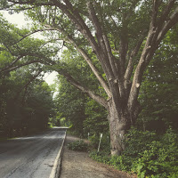
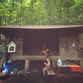
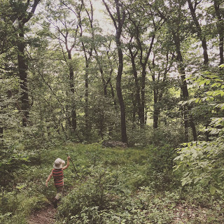
Our region is famed for its breathtaking mountains and endless hiking trails, attracting nature-lovers from all over the country. The rocky terrain that draws avid hikers to the Hudson Highlands, however, can also be a barrier for people with mobility issues. To remedy that, the Black Rock Forest Consortium created a Visitor Access Pathway that is accessible to wheelchairs, walkers, strollers, and anyone else who has trouble navigating other trails.

Construction for Phase 1 of Black Rock Forest Consortium’s new Visitor Access Pathway has been completed and is ready for the public. For the past few years, the Consortium has worked to secure a total of $570,000 for this project, landing two grants from New York State’s Environmental Protection Fund for two phases of construction of the Forest's first accessible trail.  
 
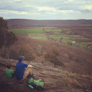
Per the grant requirements, the Consortium provides a one-to-one match of cash, staff and volunteer labor, as well as in-kind materials like native stone, putting the total project cost at well over $1 million. Phase One of the project has created a pedestrian-only trail of crushed stone, similar to a carriage road, extending from the Consortium's public parking lot on Reservoir Road for 1,500 feet through the woods to a scenic area with gorgeous views north to the Shawangunks and Catskills. This approximately quarter-mile trail will be completely accessible to those with mobility impairments. Families with strollers will also enjoy this new path.

About The Trail

The new pathway, opening on October 21, is 10 feet wide and in full compliance with ADA building standards and trail guidelines. At over a quarter-mile long, the pathway meanders through mature forests and past fern-covered cliffs, and it makes some of the region’s most rewarding views accessible to everyone.

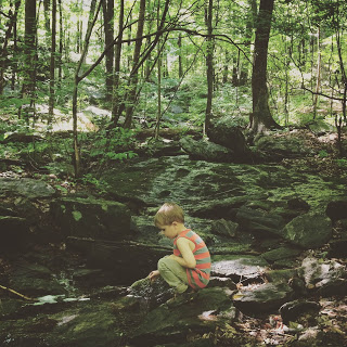
“We are looking forward to welcoming many people to Black Rock Forest for the first time, where they will discover an intact, native ecosystem that is home to a great diversity of wildlife, including more than 160 bird species,” said the Consortium’s executive director, Bill Schuster.

In addition to the birds and rare species of flora and fauna, visitors will be able to see 50 miles up the Hudson Valley, north to the Catskill and Shawangunk mountains. “The Black Rock Forest Visitor Access Pathway will provide meaningful outdoor experiences for people in places where they have not had them before,” said Douglas Hovey, the executive director of Independent Living, Inc. “There are very few outdoor resources for people with disabilities; therefore, this addition at Black Rock Forest is significant for thousands of people living with disabilities in the Hudson Valley.”

Visitors will be able to sit along the pathway on ADA-accessible benches built from Black Rock Forest wood. A second building phase to expand the trail is planned for 2017-2018.

Ribbon-Cutting Ceremony - Open to the Public

The Black Rock Forest Consortium, Independent Living, the New York State Parks Commissioner, and local government representatives are hosting an opening ceremony event on Friday, October 21, at 10 am for the ribbon-cutting ceremony and ecology stroll. RSVP to (845) 534-4517 or brfoffice@blackrockforest.org.

Parking Nearby

Parking for the Visitor Access Pathway will be at the main Black Rock Forest parking lot, which is off of Reservoir Road (off of 9W). The lot is to the right just before you reach the Black Rock Forest green metal entrance gate. This is also where the trailhead for the pathway is. 

Cat Rocks: Family-Friendly Hike in Pawling

Today we’re going to hike The Appalachian Trail. Well, 0.07% of it.

Your kids probably aren’t quite ready to hike 2,150 miles from Georgia to Maine (although they might be), but this 3-mile round-trip hike to the scenic overlook known as Cat Rocks, just below the summit of West Mountain in Pawling, is a good introduction to the AT.

Expect some company: Cat Rocks can be a crowded spot. It’s the halfway point in a popular 7.5 mile day hike that goes from the Appalachian Trail Metro-North stop on Route 22 all the way to Route 55 with a stop over at Nuclear Lake. (Guess how Nuclear Lake got its name? You’re right!) But it’s always fun to meet people who are in the middle of through-hiking, or at least tackling large sections, of the AT, and this hike even gives you a chance to check out an AT shelter.

We especially enjoy this hike in early spring when the skunk cabbage has emerged, seasonal snow-melt streams are rushing, and tasty fiddleheads and ramps can be found if you keep an eye out. Plus, since the trees haven’t filled out yet, when you get to Cat Rocks you might be able to see your car parked at the bottom.

Cat Rocks lookout in spring
On the other hand, I’m starting to think that the view from Cat Rocks is probably even better in the fall during peak leaf season. Anyone want to head up for a hike this fall?

  1. Begin by parking here on West Dover Road/Route 20, by the massive, 300-year-old oak tree known as the Dover Oak. More than one guide to the AT claims that the Dover Oak is the largest blazed tree on the entire 2,150-mile length of the trail. Speaking of blazes: You’ll be following the white blazes for pretty much the entire hike.
    Parking area
    Appalachian Trail
  2. Cross the road and take the stairs down into the skunk cabbage marsh. There are some boardwalks to take you over the muddiest parts, but you should still be wearing something waterproof on your feet. 
  3. After the marsh is the hike’s only tricky part: a rocky outcropping that you’ll have to scramble up. The ascent is gradual enough that it’s not too difficult, but if it has rained recently, the rocks can be quite slippery. Take your time, and keep a hand on the wee ones as you guide them up the slopes. 
    Rock scramble
  4. It’s smooth sailing from here. You’ll soon reach a wooden bridge that traverses a seasonal stream. Also, look for a tree on the left side of the trail right here that Cooper swore looked like a giant dinosaur foot.
    Exploring the stream
  5. Shortly after that is the junction with the 0.1 mile-long blue trail, which branches off to the left. It’s worth your time to check it out. Not only is there a beautiful rushing stream with cascades and frog ponds, but it also leads to the Telephone Pioneers Shelter - so named because it was built by the White Plains chapter of the Telephone Pioneers back in the 1980s. The Telephone Pioneers is what they used to call the volunteer service programs run by the various telephone companies. Today they’re known as the Telecom Pioneers because landlines? LOLOLOL. What’s also notable about this particular shelter is that a mini-library is attached to it, run by the Pawling Free Library. Hikers are encouraged to take, or leave, a book. The last time we visited the shelter we ran into a section hiker named Gas (all AT hikers give themselves a trail nickname) who had so far hiked the AT all the way up from Georgia, and he told us that was the first library he’d ever seen attached to a shelter. 
    Appalachian Trail: Telephone Pioneers shelter
  6. Backtrack to the junction, and continue along the white-blazed trail for the final push to the top. Cat Rocks is actually just off the trail itself. You’ll see an unmarked trail branching off to the right around here, and the view will be partly visible. Head right for about 100 feet and you’re there, facing east. Plop yourself down and have a snack! If you want to reach the true summit of West Mountain, head back to the trail and push ahead another 0.1 mile for a north-facing view. 
    Almost to the lookout
  7. From Cat Rocks, backtrack down to the trailhead. Again, use some caution when you reach the rocky, sloping outcrop near the trailhead. Honestly, we’ve found that it’s easier to just slide down most of it on your bottom. We call it “booty-scootin’” which Coop find hilarious. Then he won’t stop saying “BOOTY SCOOTIN’! BOOTY SCOOTIN’!” for, like, days. You know what? Maybe it’s better to walk down.
    Cat Rocks lookout in summer
Round-trip distance: Just under 3 miles.

Where to park: The parking shoulder is here on West Dover Road/Route 20, on the side with the giant oak tree (trust me, you can’t miss it). If you’re coming from the south: If you pass Valley View Farms Road on the right, you’ve gone too far by about a mile. If you’re coming from the north: Once you pass Valley View Farms Road on the left, start paying attention, because you’ll hit the trailhead in about a mile.

What to pack for the kids:
  • Snacks and water
  • First aid kit
  • Insect repellent (The bugs can be bad on the trail’s swampier sections in the summer.)
  • Binoculars 
  • Waterproof shoes with good grips
  • Maybe even a book to leave at the shelter library

Brian PJ Cronin, editor of Hudson Valley Parent magazine and local writer extraordinaire, shares his writing talents in focusing on family-friendly hikes for our Hiking Series. The beautiful photography is by Kristen Cronin, local do-gooder and co-founder of For Goodness Bake.


Sugarloaf Hill: Family-Friendly Hike in Garrison

Please welcome back our contributors: Brian PJ Cronin, editor of Hudson Valley Parent magazine and local writer extraordinaire, shares his writing talents in focusing on family-friendly hikes for our Hiking Series. The beautiful photography is by Kristen Cronin, local do-gooder and co-founder of For Goodness Bake. Enjoy!


Today’s hike takes us to Sugarloaf Hill in Garrison. Not to be confused with Sugarloaf Mountain in Cold Spring or the Sugarloaf Mountain ski resort in Maine or the Hudson Valley town of Sugarloaf over in Orange County or the approximately 14,000 other things in the Northeast named “Sugarloaf.” It’s a bit of a common name. Until the late 19th century, before granulated sugar became a thing, refined sugar was processed via conical molds. Once the process was done, the sugar came out of the mold in a tall, mountainous shape, called a sugarloaf. And since early Colonial settlers were too busy trying not to die of starvation and/or dysentery to be creative, they pretty much named every other mountain they saw “Sugarloaf.” So when your kids ask what a sugarloaf is, now you know what to tell them! You can leave out the dysentery part, though.

The parking lot and trailhead are across from the Garrison Institute on Route 9D.
  1. From the parking lot, backtrack the way you drove up and hang a left. Keep following the dirt road as it heads towards the hills and then bears right at another gate. You’ll start to notice red trail markers, which are the markers you’ll be following all the way to the top.
  2. Take a left into a big, beautiful meadow of tall grass and wildflowers. From here the trail is usually mowed into the grass. As you begin to ascend through the meadow, look back and you’ll get a fantastic view of West Point. Keep in mind though, as you’re all getting your Andrew Wyeth vibes on, that if you’re hiking this trail between May and July that you’re basically walking through tick-alapooza. So stick to the mowed parts, use a good tick repellent from the knees down, and do thorough tick checks on the whole family when you get home. (I should add that in the five or so times we’ve done this hike we’ve never found a tick on us, but better safe than sorry.)

  3. Partway through the meadow, the trail splits. Head straight, into the woods, and you’ll come across a wooden gazebo. Turn right, into the woods, for a small shortcut. Both paths shortly meet up again, so take either one.
  4. After crossing a small brook, the trail begins to wind up the hill. Keep an eye out for those red trail markers. There’s plenty of unmarked trails that branch off and lead to private property. On your way up, look for a large climbing boulder, a cairn atop a stone pillar, and a frog pond.
  5. Shortly after the pond you’ll come to a junction. The blue trail begins here and continues straight ahead. There’s another wooden gazebo just up ahead, if you’ve got a bit of time and want to check it out. Otherwise, hang a right to follow the red trail as it ascends. This is the only steep part of the hike, so littler hikers may need a hand here. Fortunately, the ascent is short and you’re almost to the top.
  6. In a few minutes you’ll top out at the ridge. Keep following the trail along the ridge until you reach the end point, with scenic views facing south on the Hudson River. Look around a bit and you’ll find a very rare sight for the Hudson Valley - wild cacti growing near the rocks. Yes, cacti can grow this far north, but the conditions have to be just right. And Sugarloaf Hill is one of those very special places in the Valley that’s got just the right mixture of rockiness, access to open sunlight, and ample drainage within the soil to make that happen.
  7. Backtrack down the hill to return to the parking lot. And check for ticks!
Round-trip distance: 3.1 miles

Where to park: To get to the parking lot, look for the stone gate across from the Garrison Institute on Route 9D. Above the gate, you’ll see a brown DEC sign with yellow letters that reads “Castle Rock Unique Area.” The gate says “Wing & Wing” on it. Bear left on the dirt road, and follow the signs to the lot.

What to pack for the kids:
  • Snacks and water
  • First aid kit
  • Sunscreen and hat (You’ll only need these for the beginning; once you get past the field the rest of the hike is pretty shaded.)
  • Tick repellent
  • Tick key or tweezers
  • Map (See the “East Hudson Trails” map #101 of the New York-New Jersey Trail Conference Series, which is sold at Mountain Tops.)

Earl’s Chimney: Family-Friendly Hike in Garrison

Please welcome our contributors: Brian PJ Cronin, editor of Hudson Valley Parent magazine and local writer extraordinaire, shares his writing talents in focusing on family-friendly hikes for our new Hiking Series. The beautiful photography is by Kristen Cronin, local do-gooder and co-founder of For Goodness Bake. Enjoy!


Hi! My name is Brian PJ Cronin and I’m honored that Katie has invited us to share some of our favorite family-friendly hikes in the Hudson Valley with the readers of A Little Beacon Blog.

For our purposes, we’re defining “family-friendly” as “any hike that our 3.5 year old son Cooper can walk all by himself with a manageable amount of complaining.” Although we also always tell him that if he can make it through the entire hike without being carried, he can have ice cream. Your mileage may vary.


For our first hike, we’ve chosen Earl’s Chimney in Garrison. This out-and-back hike is just over two and a half miles long (round-trip) and features a scenic overlook at the site of an old camp cabin. Only the stone chimney remains at the site, hence the name. In case you’re wondering who Earl was, or when the cabin was built, or when it was destroyed, here’s your answer: I don’t know. I even checked with the Putnam History Museum, the Putnam County historian, and the Garrison Fish & Game Club and they don’t know either. But your kids are going to ask, so better make something up. My suggestion? Ninjas.


This hike starts at the Moneyhole Mountain Access trailhead, located just across from the Garrison Fish & Game Club.

  1. Begin by taking the green trail north, as it rises and falls through pine forests and next to the bubbling Phillips Brook. There are a few opportunities to go off trail and head down to the creek if you wish, but the creek will be coming to you soon enough. We always hear woodpeckers during this first section of the trail, so keep those ears open!
  2. Soon you’ll hit the first intersection as the green trail ends and meets up with the yellow Catfish Loop. Turn right.
  3. Now the pines thin out and are replaced by scores of mountain laurels. The trail flattens out and crosses over the brook a few times, as well as a few swampy patches. Now would be a good time to mention that you should make sure you’re wearing waterproof boots. This middle section of the trail is short, but offers plenty of opportunities for puddle-splashing and creek-dipping, so you might want to factor that into your time management. One of the creek crossings also features a small hole in the rocks that you walk over, so that you can look down and see the water rushing beneath you. I am pretty sure that Cooper would live at this part of the trail if we let him.
  4. Eventually things dry out and the white trail begins to the right. The pine trees return, and during one point the trail even passes under a broken tree that fell against another tree, creating a sort of “tree arch.” As you take the white trail, you’ll finally begin to notice that you’re starting to ascend. Actually, you’ve been climbing this whole time, but so gradually that you (and your little ones) probably didn’t even notice.
  5. Soon you’ll top out at Earl’s Chimney itself, 216 feet above the trailhead. Your view is directly facing the Highland Gap across the river, which holds West Point inside of it. Look down and you’ll see parts of the Garrison County Club spread out before you.
    (Note that around the summit are several blueberry bushes, but also several buckthorn bushes as well. Buckthorn berries are similar to blueberries except they’re slightly darker, lack the distinctive “crown” that blueberries have near the base, and can cause severe cramping and diarrhea. So make sure you pack enough snacks so that hungry little hands don’t get grabby.)
  6. Backtrack from here to return to the trailhead. Just remember to turn left at both intersections now instead of right. Then, family reward time!


Round-trip distance: 2.7 miles

Where to park: By the Moneyhole Mountain Access trailhead, across from the Garrison Fish and Game Club, 183 South Highland Road. There’s a parking turnout down the street a bit, across from the lake.

What to pack for the kids:
    • Waterproof shoes or boots
    • Snacks and water
    • First aid kit
    • Binoculars (We always forget to bring these and always regret it.)
    • Sunscreen and hat (most of the trail is shaded, but the terminus is open and sunny)
    • Bug spray (just in case)
    • A map (See the “East Hudson Trails” map #103 of the New York-New Jersey Trail Conference Series, which is sold at Mountain Tops. On this map, Earl’s Chimney is referred to as “Chimney Top.”)